On the map, Wells Gray Provincial Park is a large green spot centred on the Clearwater Valley of east-central British Columbia. On the ground, at 540,000 ha, it is as large as, or larger than, one in every five nations on earth.

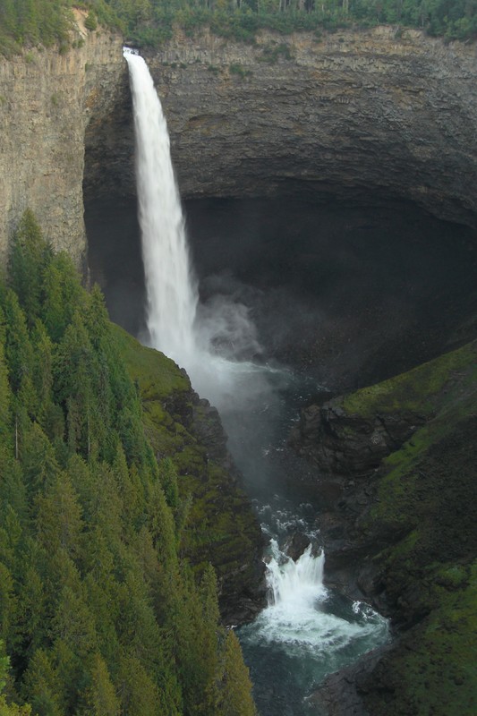 Even if you have never heard of Wells Gray Park itself, you’ve likely seen images of its iconic beating heart, which is Helmcken Falls.
What’s truly exceptional about Wells Gray Provincial Park – what sets it apart from most large protected areas – is that it preserves a vast, integrated ecosystem: the watershed of the Clearwater River – whence the park’s serrated, leaf-like outline.
Being ecologically defined has long given Wells Gray a presence that in some ways feels life-like: a park pulsing with its own internal circulatory system: its hundreds of streams and second-order rivers rising along its mountain boundaries, and all at length converging into a single midrib of river, the Clearwater, which the drains southward along a narrow petiole-like extension of park land. The lives of a leaf.
 Only in the south are its boundaries somewhat arbitrary – a shortcoming that has been under repair more or less since the park was established.
That was in 1939. Since then the B.C. government has twice adjusted Wells Gray southwards: once in the mid 50s, and again in the mid 90s. On each occasion the impetus behind the boundary adjustment was a desire to encompass the winter range of the park’s Mountain Caribou – a hallmark animal that loomed large in Wells Gray’s establishment in the first place. Click here for more information.